Nossos serviços estão apresentando instabilidade no momento. Algumas informações podem não estar disponíveis.
-
Home

-
Geosciences
-
Territorial organization
-
Territorial Organization
- NP-Territorial structure
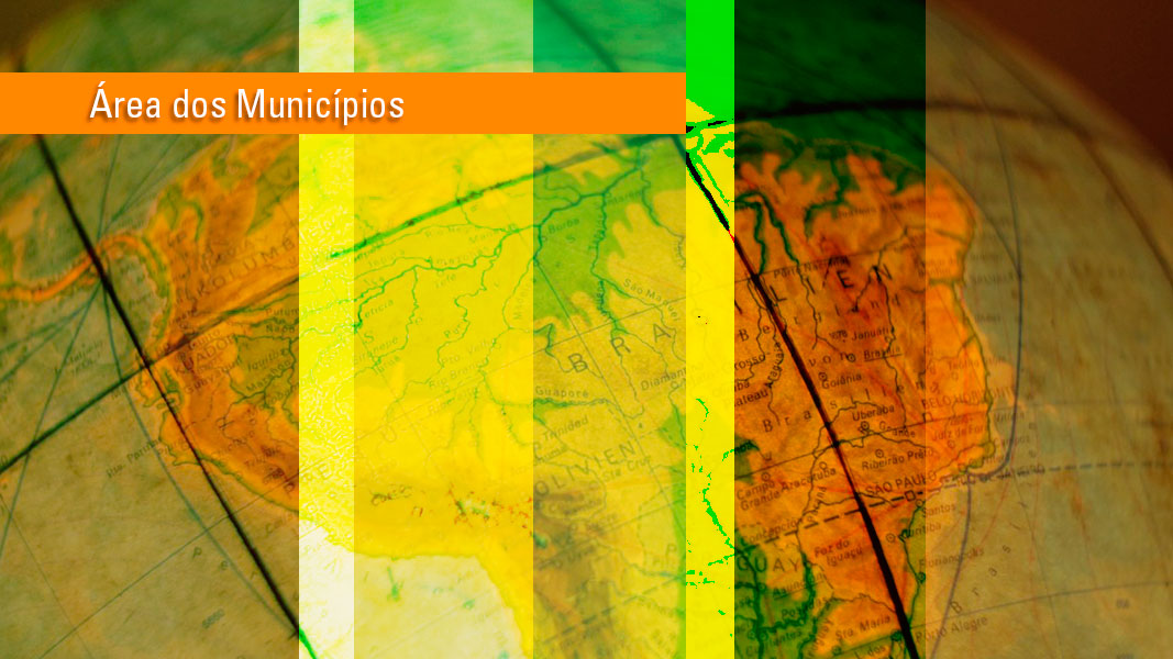
Territorial Areas
Description
It is the annual re-processing of the values of the territorial areas of the 5,568 municipalities, plus the Federal District and the State District of Fernando de Noronha. It is produced by the IBGE according to the political-administrative structure in force on July 1, 2021, reference date of the 2021 Population Estimates.
These data include the updating of the municipal territorial boundaries occurred after the 2010 Population Census and those practiced in the Annual Population Estimates in the 2011-2021 period, as well as other territorial adjustments occurred in this period included in the 2021 Digital Municipal Mesh, annually produced by the Coordination of Territorial Structures of the IBGE´s Directorate of Geosciences to meet the steps of Data Collection, Calculation, Tabulation, Analysis and Statistical and Geographic Dissemination associated with Household Surveys, Annual Population Estimates and Censuses.
For the Brazilian surface, the value of 8,510,345,540 km2 was calculated and published in the Official Gazette no. 38, of February 23, 2022, according to Ordinance no. PR-73, of February 21, 2022.
Resolutions and Legislation
Portaria Nº PR-1390, de 5 de dezembro de 2024
O PRESIDENTE da FUNDAÇÃO INSTITUTO BRASILEIRO DE GEOGRAFIA E ESTATÍSTICA - IBGE, no uso de suas atribuições contidas no art. 20 do Estatuto aprovado pelo DecretoO PRESIDENTE da FUNDAÇÃO INSTITUTO BRASILEIRO DE GEOGRAFIA E ESTATÍSTICA - IBGE, no uso de suas atribuições contidas no art. 20 do Estatuto aprovado pelo Decreto nº 11.177, de 18 de agosto de 2022, e considerando que a coleta, a análise e a divulgação de estatísticas pertinentes a determinados recortes territoriais frequentemente demandam a necessidade de revisão periódica das áreas dos Estados e Municípios, em face da dinâmica da divisão territorial brasileira, em função de alterações de natureza legal, judicial ou pela ampliação contínua de melhores representações cartográficas dos polígonos estaduais e municipais, com o apoio de novas geotecnologias utilizadas na estruturação da Base Territorial, sendo referência para as pesquisas e publicações desta Fundação, RESOLVE:
Do objeto e do âmbito de aplicação
Art. 1º Aprovar os valores de áreas territoriais do Brasil, Estados e Municípios, constantes para consulta ou download no endereço a seguir a partir do dia 17 de dezembro de 2024:
https://www.ibge.gov.br/geociencias/organizacao-do-territorio/estrutura-territorial/15761-areas-dos-municipios.html?=&t=acesso-ao-produto, que apresenta o quadro territorial vigente em 30 de abril de 2023, data de referência do recebimento das atualizações territoriais enviadas pelos Estados ao IBGE.
Das disposições gerais
Art. 2º Atribuir à Diretoria de Geociências a emissão das certidões de valores de áreas territoriais dos municípios.
Art. 3º Atribuir à Diretoria de Geociências, em articulação com o Centro de Documentação e Disseminação de Informações (CDDI), a disseminação dos novos valores para as áreas territoriais.
Da revogação
Art. 4º Fica revogada a Portaria do Presidente/IBGE nº 197, de 21 de março de 2023.
Art. 5° Esta Portaria entra em vigor em 17 de dezembro de 2024.
MARCIO POCHMANN
(Publicada no DOU nº 237 de 10/12/2024, Seção 1 página 99)
Portaria Nº PR-197, de 21 de março de 2023
O PRESIDENTE SUBSTITUTO da FUNDAÇÃO INSTITUTO BRASILEIRO DE GEOGRAFIA E ESTATÍSTICA(IBGE), no uso de suas atribuições contidas no art. 20 do Estatuto aprovado pelo Decreto nº 11.177,de 18 de agosto de 2022, e considerando que a coleta, a análise e a divulgação de estatísticas pertinentes a determinados recortes territoriais frequentemente demandam a revisão periódica das áreas dos Estados e Municípios, em face da dinâmica da divisão territorial brasileira, em função de alterações de natureza legal, judicial ou pela ampliação contínua de melhores representações cartográficas dos polígonos estaduais e municipais, com o apoio de novas geotecnologias utilizadas na estruturação da Base Territorial, sendo referência para as pesquisas e publicações desta Fundação, RESOLVE:
Do objeto e do âmbito de aplicação
Art. 1º Aprovar os valores de áreas territoriais do Brasil, Estados e Municípios, constantes para consulta ou download no endereço a seguir a partir do dia 29 de março de 2023: https://www.ibge.gov.br/geociencias/organizacao-do-territorio/estrutura-territorial/15761-areas-dos-municipios.html?=&t=acesso-ao-produto, que apresenta o quadro territorial vigente em 31 de julho de 2022, data de referência do recebimento das atualizações territoriais enviadas pelos Estados ao IBGE.
Das disposições gerais
Art. 2º Atribuir à Diretoria de Geociências a emissão das certidões de valores de áreas territoriais dos municípios.
Art. 3º Atribuir à Diretoria de Geociências, em articulação com o Centro de Documentação e Disseminação de Informações (CDDI), a disseminação dos novos valores para as áreas territoriais.
Da revogação
Art. 4º Fica revogada a Portaria do Presidente/IBGE nº 73, de 21 de fevereiro de 2022.
Art. 5° Esta Portaria entra em vigor em 29 de março de 2023.
CIMAR AZEREDO PEREIRA
(Publicada no DOU nº 59 de 27/3/2023, Seção 1 página 88)
Portaria Nº PR-73, de 21 de fevereiro de 2022
O PRESIDENTE DA FUNDAÇÃO INSTITUTO BRASILEIRO DE GEOGRAFIA E ESTATÍSTICA (IBGE), no uso de suas atribuições contidas no Art. 22 do Estatuto aprovado pelo Decreto nº 10.859, de 19 de novembro de 2021, e considerando que a coleta, a análise e a divulgação de estatísticas pertinentes a determinados recortes territoriais frequentemente demandam a necessidade de revisão periódica das áreas das superfícies dos Estados e Municípios, face à dinâmica da divisão territorial brasileira, em função de alterações de natureza legal, judicial ou pela ampliação contínua de melhores representações cartográficas dos polígonos estaduais e municipais com o apoio de novas geotecnologias, utilizadas na estruturação da Base Territorial sendo referência para as pesquisas e publicações dessa Fundação, resolve:
Art. 1º Aprovar os valores de áreas territoriais do Brasil, Estados e Municípios, constantes para consulta ou download no endereço abaixo, a partir do dia 09 de março de 2022: https://www.ibge.gov.br/geociencias/organizacao-do-territorio/estrutura-territorial/15761-areas-dos-municipios.html, que segue o quadro territorial vigente em 30/04/2021, data de referência do recebimento das atualizações territoriais enviadas pelos Estados ao IBGE e processadas com vistas as Estimativas de População 2021.
Art. 2º Delegar ao Diretor de Geociências a emissão das certidões de valores de áreas territoriais dos municípios. Os valores de área estão de acordo com o quadro territorial vigente em 30/04/2021, data de referência do recebimento das atualizações territoriais enviadas pelos Estados ao IBGE e processadas com vistas as Estimativas de População 2021.
Art. 3º Atribuir à Diretoria de Geociências, articulada com o Centro de Documentação e Disseminação de Informações (CDDI), a disseminação dos novos valores para as áreas territoriais.
Art. 4º Esta Portaria revoga a Portaria nº 47, de 1° de março de 2021.
Art. 5º Esta Portaria entra em vigor em 02 de março de 2022.
EDUARDO L. G. RIOS NETO
(Publicada no DOU nº 38 de 23/2/2022, Seção 1 página 98)
Portaria Nº PR-47, de 1º de março de 2021
Competência: Art. 24 do Estatuto aprovado pelo Decreto nº 4.740, de 13 de junho de 2003. A PRESIDENTE DA FUNDAÇÃO INSTITUTO BRASILEIRO DE GEOGRAFIA E ESTATÍSTICA (IBGE), no uso de suas atribuições, e considerando que a coleta, a análise e a divulgação de estatísticas pertinentes a determinados recortes territoriais frequentemente demandam a necessidade de revisão periódica das áreas das superfícies dos Estados e Municípios, face à dinâmica da divisão territorial brasileira, em função de alterações de natureza legal, judicial ou pela ampliação contínua de melhores representações cartográficas dos polígonos estaduais e municipais com o apoio de novas geotecnologias, utilizadas na estruturação da Base Territorial sendo referência para as pesquisas e publicações dessa Fundação, RESOLVE:
Art. 1º - Aprovar os valores de áreas territoriais do Brasil, Estados e Municípios, constantes para consulta ou download no endereço abaixo, a partir do próximo dia 1º de março:
https://www.ibge.gov.br/geociencias-novoportal/organizacao-do-territorio/estrutura-territorial/15761-areas-dos-municipios.html?=&t=o-que-e, que segue o quadro territorial vigente em 30/06/2020, data de referência das Estimativas Populacionais 2020.
Art. 2º. Delegar ao Diretor de Geociências a emissão das certidões de valores de áreas territoriais dos municípios.
Art. 3º. Atribuir à Diretoria de Geociências, articulada com o Centro de Documentação e Disseminação de Informações (CDDI), a disseminação dos novos valores para as áreas territoriais.
Art. 4º - A presente Resolução entra em vigor nesta data, revogada a Portaria nº 177, de 15 de maio de 2020.
Susana Cordeiro Guerra
(Publicada no DOU nº 41 de 3/3/2021, Seção 1 página 18)
Portaria nº 177, de 15 de maio de 2020
Competência: Art. 24 do Estatuto aprovado pelo Decreto nº 4.740, de 13 de junho de 2003.
A PRESIDENTE DA FUNDAÇÃO INSTITUTO BRASILEIRO DE GEOGRAFIA E ESTATÍSTICA (IBGE), no uso de suas atribuições, e considerando que a coleta, a análise e a divulgação de estatísticas pertinentes a determinados recortes territoriais frequentemente demandam a necessidade de revisão periódica das áreas das superfícies dos Estados e Municípios, face à dinâmica da divisão territorial brasileira, em função de alterações de natureza legal, judicial ou pela ampliação contínua de melhores representações cartográficas dos polígonos estaduais e municipais com o apoio de novas geotecnologias, utilizadas na estruturação da Base Territorial sendo referência para as pesquisas e publicações dessa Fundação, RESOLVE:
Art. 1º - Aprovar os valores de áreas territoriais do Brasil, Estados e Municípios, constantes para consulta ou download no endereço abaixo, a partir do próximo dia 20 de maio:
https://www.ibge.gov.br/geociencias-novoportal/organizacao-do-territorio/estrutura-territorial/15761-areas-dos-municipios.html?=&t=o-que-e, que segue o quadro territorial vigente em 30/04/2019, data de referência das Estimativas Populacionais 2019, processada em 2019.
Art. 2º. Delegar ao Diretor de Geociências a emissão das certidões de valores de áreas territoriais dos municípios.
Art. 3º. Atribuir à Diretoria de Geociências, articulada com o Centro de Documentação e Disseminação de Informações (CDDI), a disseminação dos novos valores para as áreas territoriais.
Art. 4º - A presente Resolução entra em vigor nesta data, revogada a Resolução da Presidência nº 1, de 18 de março de 2019.
Susana Cordeiro Guerra
(Publicada no DOU nº 94 de 19/05/2020, Seção 1 página 32)..
Resolução Nº PR-01, de 18 de março de 2019
Competência: Art. 24 do Estatuto aprovado pelo Decreto nº 4.740, de 13 de junho de 2003.
A PRESIDENTE DA FUNDAÇÃO INSTITUTO BRASILEIRO DE GEOGRAFIA E ESTATÍSTICA (IBGE), no uso de suas atribuições, e considerando que a coleta, a análise e a divulgação de estatísticas pertinentes a determinados recortes territoriais frequentemente demandam a necessidade de revisão periódica das áreas das superficies dos Estados e Municípios, face à dinâmica da divisão territorial brasileira, em função de alterações de natureza legal, judicial ou pela ampliação contínua de melhores representações cartográficas dos polígonos estaduais e municipais com o apoio de novas geotecnologias, utilizadas na estruturação da Base Territorial sendo referência para as pesquisas e publicações dessaFundação,
RESOLVE:
Art. 1º - Aprovar os valores de áreas territoriais do Brasil, Estados e Municípios, constantes para consulta ou download no endereço abaixo, a partir do próximo dia 19 de março:
https://www.ibge.gov.br/geociencias-novoportal/organizacao-do-territorio/estrutura-territorial/15761-areas-dos-municipios.html?=&t=o-que-e, segundo o quadro territorial vigente em 30/04/2018, data de referência das Estimativas Populacionais 2018, processada em 2018.
Art. 2º. Delegar ao Diretor de Geociências a emissão das certidões de valores de áreas territoriais dos municípios.
Art. 3º. Atribuir à Diretoria de Geociências, articulada com o Centro de Documentação e Disseminação de Informações (CDDI), a disseminação dos novos valores para as áreas territoriais.
Art. 4º - A presente Resolução entra em vigor nesta data, revogada a Resolução da Presidência nº 1, de 28 de junho de 2018.
Susana Cordeiro Guerra
(Publicada no DOU nº 53 de 19/03/2019, Seção 1 página 15)
Resolução Nº PR-01, de 28 de junho de 2018
Competência: Art. 24 do Estatuto aprovado pelo Decreto nº 4.740, de 13 de junho de 2003.
O PRESIDENTE DA FUNDAÇÃO INSTITUTO BRASILEIRO DE GEOGRAFIA E ESTATÍSTICA (IBGE), no uso de suas atribuições, e considerando que a coleta, a análise e a divulgação de estatísticas pertinentes a determinados recortes territoriais frequentemente demandam a necessidade de revisão periódica das áreas das superficies dos Estados e Municípios, face à dinâmica da divisão territorial brasileira, em função de alterações de natureza legal, judicial ou pela ampliação contínua de melhores representações cartográficas dos polígonos estaduais e municipais com o apoio de novas geotecnologias, utilizadas na estruturação da Base Territorial sendo referência para as pesquisas e publicações dessaFundação,
RESOLVE:
Art. 1º - Aprovar os valores de áreas territoriais do Brasil, Estados e Municípios, constantes para consulta ou download no endereço abaixo, a partir do próximo dia 29 de junho:
https://www.ibge.gov.br/home/geociencias/cartografia/default_territ_area.shtm, segundo o quadro territorial vigente em 01/07/2017, data de referência das Estimativas Populacionais 2017, processada em 2017.
Art. 2º. Delegar ao Diretor de Geociências a emissão das certidões de valores de áreas territoriais.
Art. 3º. Atribuir à Diretoria de Geociências, articulada com o Centro de Documentação e Disseminação de Informações (CDDI), a disseminação dos novos valores para as áreas territoriais.
Art. 4º - A presente Resolução entra em vigor nesta data, revogada a Resolução da Presidência nº 2, de 29 de junho de 2017.
Roberto Luís Olinto Ramos
(Publicada no DOU nº 124 de 29/06/2018, Seção 1 página 122)
Resolução Nº PR-02, de 29 de junho de 2017
O PRESIDENTE EM EXERCÍCIO DA FUNDAÇÃO INSTITUTO BRASILEIRO DE GEOGRAFIA E ESTATÍSTICA - IBGE, no uso de suas atribuições contidas no Art. 24 do Estatuto aprovado pelo Decreto Nº 4.740, de 13 de junho de 2003, e considerando que a coleta, a análise e a divulgação de estatísticas pertinentes a determinados recortes territoriais frequentemente demandam a necessidade de revisão periódica das áreas das superfícies dos Estados e Municípios, face à dinâmica da divisão territorial brasileira, em função de alterações de natureza legal, judicial ou pela ampliação contínua de melhores representações cartográficas dos polígonos estaduais e municipais com o apoio de novas geotecnologias, utilizadas na estruturação da Base Territorial sendo referência para as pesquisas e publicações dessa Fundação,
RESOLVE
Art. 1º - Aprovar os valores de áreas territoriais do Brasil, Estados e Municípios, constantes para consulta ou download no endereço abaixo, a partir do próximo dia 30 de junho:
https://www.ibge.gov.br/home/geociencias/cartografia/default_territ_area.shtm, segundo o quadro territorial vigente em 01/07/2016, data de referência das Estimativas Populacionais 2016, processada em 2017.
Art. 2º. Delegar ao Diretor de Geociências a emissão das certidões de valores de áreas territoriais.
Art. 3º. Atribuir à Diretoria de Geociências, articulada com o Centro de Documentação e Disseminação de Informações (CDDI), a disseminação dos novos valores para as áreas territoriais.
Art. 4º - A presente Resolução entra em vigor nesta data, revogada a Resolução da Presidência nº 2, de 21 de junho de 2016.
Fernando José de Araújo Abrantes
(Publicada no DOU nº 124 de 30/06/2017, Seção 1 página 96)
Resolução Nº PR-02, de 21 de junho de 2016
A PRESIDENTA DA FUNDAÇÃO INSTITUTO BRASILEIRO DE GEOGRAFIA E ESTATÍSTICA (IBGE), no uso de suas atribuições, e considerando que a coleta, a análise e a divulgação de estatísticas pertinentes a determinados recortes territoriais frequentemente demandam a necessidade de revisão periódica das áreas das superfícies dos Estados e Municípios, face à dinâmica da divisão territorial brasileira, em função de alterações de natureza legal, judicial ou pela ampliação contínua de melhores representações cartográficas dos polígonos estaduais e municipais com o apoio de novas geotecnologias, utilizadas na estruturação da Base Territorial sendo referência para as pesquisas e publicações dessa Fundação,
RESOLVE
Art. 1º - Aprovar os valores de áreas territoriais do Brasil, Estados e Municípios, constantes para consulta ou download no endereço abaixo, a partir do próximo dia 30 de junho:
https://www.ibge.gov.br/home/geociencias/cartografia/default_territ_area.shtm, segundo o quadro territorial vigente em 01/07/2015, data de referência das Estimativas Populacionais 2015, processada em 2016.
Art. 2º. Delegar ao Diretor de Geociências a emissão das certidões de valores de áreas territoriais.
Art. 3º. Atribuir à Diretoria de Geociências, articulada com o Centro de Documentação e Disseminação de Informações (CDDI), a disseminação dos novos valores para as áreas territoriais.
Art. 4º - A presente Resolução entra em vigor nesta data, revogada a Resolução da Presidência nº 7, de 04 de dezembro de 2015.
Wasmália Socorro Barata Bivar
(Publicada no DOU nº 118 de 22/06/2016, Seção 1 página 87)
Resolução Nº PR-07, de 04 de dezembro de 2015
A PRESIDENTA DA FUNDAÇÃO INSTITUTO BRASILEIRO DE GEOGRAFIA E ESTATÍSTICA (IBGE), no uso de suas atribuições, e considerando que a coleta, a análise e a divulgação de estatísticas pertinentes a determinados recortes territoriais frequentemente demandam a necessidade de revisão periódica das áreas das superfícies dos Estados e Municípios, face à dinâmica da divisão territorial brasileira, em função de alterações de natureza legal, judicial ou pela ampliação contínua de melhores representações cartográficas dos polígonos estaduais e municipais com o apoio de novas geotecnologias, utilizadas na estruturação da Base Territorial sendo referência para as pesquisas e publicações dessa Fundação,
RESOLVE
Art. 1º - Aprovar os valores de áreas territoriais do Brasil, Estados e Municípios, constantes para consulta ou download no endereço: https://www.ibge.gov.br/home/geociencias/cartografia/default_territ_area.shtm, segundo o quadro territorial vigente em 01/07/2014, data de referência das Estimativas Populacionais 2014, processada em 2015.
Art. 2º. Delegar ao Diretor de Geociências a emissão das certidões de valores de áreas territoriais.
Art. 3º. Atribuir à Diretoria de Geociências, articulada com o Centro de Documentação e Disseminação de Informações (CDDI), a disseminação dos novos valores para as áreas territoriais.
Art. 4º - A presente Resolução entra em vigor nesta data, revogada a Resoluções da Presidência nº 4, de 22 de outubro de 2014.
Wasmália Socorro Barata Bivar
(Publicada no DOU nº 234 de 08/12/2015, Seção 1 página 86)
Resolução Nº PR-04, de 22 de dezembro de 2014
A PRESIDENTA DA FUNDAÇÃO INSTITUTO BRASILEIRO DE GEOGRAFIA E ESTATÍSTICA - IBGE, no uso de suas atribuições contidas no Art. 24 do Estatuto aprovado pelo Decreto Nº 4.740, de 13 de junho de 2003, e considerando que a coleta, a análise e a divulgação de estatísticas pertinentes a determinados recortes territoriais frequentemente demandam a necessidade de revisão periódica das áreas das superfícies dos Estados e Municípios, face à dinâmica da divisão territorial brasileira, em função de alterações de natureza legal, judicial ou pela ampliação contínua de melhores representações cartográficas dos polígonos estaduais e municipais com o apoio de novas geotecnologias, utilizadas na estruturação da Base Territorial sendo referência para as pesquisas e publicações dessa Fundação, resolve:
Art. 1º. Aprovar os valores de áreas territoriais do Brasil, Estados e Municípios, constantes para consulta ou download no endereço: https://www.ibge.gov.br/home/geociencias/cartografia/default_territ_area.shtm, segundo o quadro territorial vigente em 01/07/2013, data de referência das Estimativas Populacionais 2013, processada em 2014.
Art. 2º. Delegar ao Diretor de Geociências a emissão das certidões de valores de áreas territoriais.
Art. 3º. Atribuir à Diretoria de Geociências, articulada com o Centro de Documentação e Disseminação de Informações (CDDI), a disseminação dos novos valores para as áreas territoriais.
Art. 4º - A presente Resolução entra em vigor nesta data, revogadas as Resoluções da Presidência nº 5, de 10 de outubro de 2002, nº 2 de 12 de maio de 2008, nº 01 de 15 de janeiro de 2013 e demais disposições contrárias.
Wasmália Socorro Barata Bivar
(Publicada no DOU nº 248 de 23/12/2014, Seção 1 página 122)
Resolução Nº 01, de 15 de janeiro de 2013
A PRESIDENTA DA FUNDAÇÃO INSTITUTO BRASILEIRO DE GEOGRAFIA E ESTATÍSTICA (IBGE), no uso de suas atribuições, e considerando que a coleta, a análise e a divulgação de estatísticas pertinentes a determinados recortes territoriais frequentemente demandam a necessidade de revisão periódica das áreas das superfícies dos Estados e Municípios, face à dinâmica da divisão territorial brasileira, em função de alterações de natureza legal, judicial ou por melhor representação cartográfica dos polígonos estaduais, municipais e de setores censitários, utilizados no Censo Demográfico 2010, com o uso de geotecnologias disponíveis, resolve:
Art. 1º - Aprovar os valores de áreas territoriais do Brasil, Estados e Municípios, constantes dos ANEXOS desta Resolução, segundo o quadro territorial vigente na data de referência do Censo Demográfico, 1º/8/2010.
Art. 2º - Delegar ao Diretor de Geociências a emissão das certidões de valores de áreas territoriais.
Art. 3º - Atribuir à Diretoria de Geociências, articulada com o Centro de Documentação e Disseminação de Informações (CDDI), a disseminação dos novos valores para as áreas territoriais.
Art. 4º - A presente Resolução entra em vigor nesta data, revogadas as Resoluções da Presidência nº 5, de 10 de outubro de 2002, e nº 2, de 12 de maio de 2008, e demais disposições contrárias.
Wasmália Socorro Barata Bivar
(Publicada no DOU nº 16 de 23/01/2013, Seção 1 págs 48 com ANEXOS até 60)
Resolução Nº 05, de 10 de outubro de 2002
O Presidente do INSTITUTO BRASILEIRO DE GEOGRAFIA E ESTATÍSTICA - IBGE, usando de suas atribuições e considerando que a coleta, a análise e a divulgação de estatísticas pertinentes a determinados recortes territoriais, freqüentemente demandam conhecimentos sobre as áreas das superfícies contidas pelos polígonos circundantes destes territórios, e considerando que a Diretoria de Geociências-DGC promoveu a revisão e a atualização dos valores das áreas dos Estados e dos Municípios, empregando processos computacionais que permitiram a fixação das coordenadas dos pontos que integram os perímetros dessas superfícies territoriais, a partir da consolidação do Arquivo Gráfico Municipal-AGM, resolve:
Art. 1º - Aprovar os valores constantes nas tabelas anexas, para as áreas territoriais dos Estados e Municípios Brasileiros, segundo quadro territorial vigente em 01/01/2001.
Art. 2º - Delegar ao Diretor de Geociências a emissão das certidões de valores de áreas territoriais.
Art. 3º - Atribuir à Diretoria de Geociências articulada com o Centro de Documentação e Disseminação de Informações-CDDI, a disseminação dos novos valores para as áreas territoriais.
Art. 4º - A presente Resolução entra em vigor nesta data revogadas as disposições contrárias.
Sérgio Besserman Vianna
(Publicado no Diário Oficial da União Nº 198 - Seção 1, de 11/10/2002, p. 48 à 65)
About the publication - 2023
Resizing of areas is part of the evolution of the geo-technologies applied to the monitoring of the dynamics of the Brazilian territorial division, which involves the periodic update of the state and municipal areas using the best techniques and production inputs, as well as to reflect possible changes in the political-administrative borders due to legal reasons.
The calculation of the Brazilian territorial area in 2023 resulted in the total value of 8,510,417.822 km2, without any significant update in relation to the previous year.
The reference values for each Federation Unit can be accessed through spreadsheets in the formats Microsoft Excel (.xls) and OpenOffice-Calc (.ods) or via attributes in the vector files of the Digital Municipal Mesh. The data are available on the website for download:
https://www.ibge.gov.br/en/geosciences/territorial-organization/territorial-meshes/2786-np-municipal-mesh/18890-municipal-mesh.html?lang=en-GB
The complete documentation in relation to the technical, historical and legal characteristics concerning the use of the Digital Municipal Mesh is described in the Methodological Note "Digital Municipal Mesh and Territorial Areas 2022: Digital Municipal Mesh and Territorial Areas 2022: Technical and Legal Information for Using Published Data", whose PDF file is among the Territorial Areas 2022 files available on:
https://biblioteca.ibge.gov.br/index.php/biblioteca-catalogo?view=detalhes&id=2102152
More on the product - 2023
Publications - 2023
Informações técnicas e legais para a utilização dos dados publicados / IBGE, Coordenação de Estruturas Territoriais
Material type: Book
Year: 2024
Learn more - 2023
Background
The first official estimate for the surface extension of the Brazilian territory dates back to 1889. The value of 8,337,218 km2 was obtained from measurements and calculations on the basic sheets of the Empire Letter of Brazil, published in 1883.
From 1922 onwards, the estimate included in the Brazilian official publications, authored by the Organizing Commission of the Letter of Brazil, of the Engineering Club, was 8,511,189 km2. The difference of 173,971 km2 in relation to the first estimate was explained by the territorial additions registered in the Republican period, as well as by a better quality of the supporting cartographic documentation and a more thorough calculation, based on the use of mechanical planimeters.
With the enactment of Decree-Law no. 237, of February 2, 1938, it became an attribution of the IBGE - through the National Council of Geography -, according to Article 9, letter a, "...the revision of the Brazilian area, of its parceling according to the Federation Units and municipalities, accomplishing, whenever possible, the set of district areas..."
With the progress of the cartographic work in 1945, especially the update of the Letter of Brazil to the Millionth, the official Brazilian area was revised. By means of Resolution no. 195, of June 22, 1946, the General Assembly of the National Council of Geography approved the release and official use of the value of 8,516,037 km2.
The design and publication of new sheets of the Letter of Brazil to the Millionth allowed to revise the outline of international and interstate borders, as well as the shoreline. The studies and geographic interpretations to establish the borders of internal and territorial waters was based on concepts then released by the United States Bureau of the Census. Therefore, the revision of the Brazilian area, approved by Resolution no. 392, of October 29, 1952, of the General Assembly of the National Council of Geography, made official the value of 8,513,844 km2.
Following the concepts that guided the revision of the works in the early 1950s and taking advantage the successive editions of the sheets of the Letter to the Millionth, the areas of Brazil, states and municipalities began to be revised on a ten-year basis. In this sequence, the value released for the 1980s was 8,511,965 km2.
In the 1990s, a technical, methodological and conceptual redesign began in the calculation of the state and municipal areas. The automated processing gained strength from the digitalization of the topographic letters onwards. Since then, the continuous improvement in the calculation of the territorial areas has been gaining quality, reflected in gaps in relation to the results previously released for the state and municipal surfaces. It should be clarified that article 18 of the Federal Constitution of 1988 gave states and municipalities the responsibility for territorial changes.
According to the political-administrative structure in effect on December 31, 1993, the values of the territorial areas added up the Brazilian surface to 8,547,403.5 km2 (including the ocean islands), which corresponds to a difference of more 0.42% in relation to the previous value. For most states, the differences between the values relative to December 31, 1993, and those previously published in the 1980s do not exceed 0.6% of the territorial area. The exceptions are the states of Pernambuco, Alagoas and Paraíba, with differences of +5%, -4% and +4%, respectively, resulting from the revision of the state borders on more precise cartographic bases, as well as from the introduction of a new calculation methodology.
In 1997, large-scale automatic and semi-automatic digitalization began with the use of new equipment and computer programs. This change in the modus operandi of the digitalization influenced the results, producing new values for the areas of municipalities from 1999 onwards. The new methodology adopted the Equivalent Cylinder Projection as cartographic projection, in which area deformation does not exist.
The recalculation of the areas for the 2000 Census followed this conception of continuous improvement. The resulting Brazilian area, published in the 2000 Census Preliminary Synopsis, was 8,514,215.3 km2, recording a difference of 33,188.2 km2 or nearly 0.39% less in relation to the value in the 1990s. The population estimate for 2000 included the area of 2,977.4 km2 relative to the historical conflict between the states of Ceará and Piauí. The information relative to the population of that area was collected in that Census in specific enumeration areas and incorporated into the appropriate municipalities.
The values of the territorial areas according to the political-administrative structure in effect on January 1, 2001 (Resolution of the IBGE´s Presidency R.PR-5/02, of October 10, 2002) added up to the value of 8,514,876.599 km2 for the Brazilian surface, which corresponds to an increase of nearly 0.008% in the value published in the 2000 Census Preliminary Synopsis, with the following incorporations:
- The areas of the islands of Trindade and Martins Vaz were incorporated into the municipality of Vitória (ES), according to a municipal law following Decree no. 8,054, which creates the Municipal Ecological Reserve of Ocean Islands;
- In Rio Grande do Sul, the areas relative to Lagoa dos Patos and Mirim were incorporated into the area of the state, according to the State Constitution of 1988;
- Still in relation to Rio Grande do Sul, it should be clarified that the municipality of Pinto Bandeira had its area (105,156 km2) aggregated to the original municipality, Bento Gonçalves, due to a Precautionary Measure, which temporarily suspended Law no. 11,375/99, which created that municipality.
- In the state of Rio de Janeiro, the areas of the municipalities of Carapebus, Conceição de Macabu and Macaé comply with the judicial injunction.
Having as spatial reference the mesh of polygons of the urban and rural enumeration areas of the national territory, the area of Brazil resulted in 8,515,692.272 km2 for the 2010 Census Synopsis, indicating an increase of nearly 0.01% in relation to the value published in 2001, highlighted by the following changes:
- The area of the state of Bahia incorporated the values of the insular areas of the Abrolhos Archipelago, which is subordinate to the municipality of Caravelas, according to General Law no. 12,978, of June 1, 1944;
- The area of the state of Santa Catarina incorporated the values of the area relative to the inland waters of the South Bay and North Bay, between the continent and the island of Santa Catarina, according to Law no. 13,993, of March 20, 2007, which revoked Law no. 11,340, of January 8, 2000...;
Although they do not have any effect on the total value calculated for the Brazilian area, some changes in the areas previously published for some states are due to cartographic changes required for different reasons, as highlighted below:
- Cartographic adjustments officially informed to the IBGE by state offices in charge of the political-administrative structure, according to the Federal Constitution of 1988;
- Adjustments in the values of the areas of the states of Ceará, Pernambuco and Paraíba according to the borders described in the Border Atlas (CNG, 1940), reference document for every interstate border in Brazil;
- Adjustments in the values of the areas of the states of Alagoas and Pernambuco, according to Decree-Law no. 9,578, of August 13, 1946;
- Establishment of the values for the areas of the states of Acre and Amazonas from the sentence of the Federal Supreme Court of December 4, 1996, according to the Resolution of the IBGE´s Presidency no. 02, of May 12, 2008;
- Adoption of the values for the areas of the states of Tocantins and Bahia in compliance with the decision of the Federal Supreme Court in the Precautionary Measure no. 733-O of the state of Tocantins; the adoption of these borders will be used up to the final judgment by the Federation Supreme Court of the Primary Civil Suits no. 347 and 652;
- Changes in the territorial pertinence of some localities through judicial decisions (injunctions and warrants) or through decision of the IBGE´s Federal Attorney.
The calculation of Brazilian territorial area in 2013 resulted in the total value of 8,515,767.049 km2, in which the major changes in territorial values are highlighted:
- Proportional municipal changes due to the creation of five new municipalities, adding up to 5,570 Brazilian municipalities in 2013:
- The municipality of Mojuí dos Campos was installed in the state of Pará on January 1, 2023, with an area of 4,988.236 km2 as a break-up of the municipality of Santarém;
- The municipalities of Pescaria Brava, with an area of 105.169 km2, a break-up of the municipality of Laguna, and of Balneário Rincão, with an area of 64.636 km2, a break-up of the municipality of Içara, were installed in the state of Santa Catarina.
- The municipality of Pinto Bandeira was installed in Rio Grande do Sul on January 1, 2013, with an area of 105.072 km2, a break-up of the municipality of Bento Gonçalves;
- The municipality of Paraíso das Águas was installed in Mato Grosso do Sul on January 1, 2013, with ana area of 5,032.469 km2, a break-up of the municipalities of Costa Rica, Chapadão do Sul and Água Clara.
In the state of Bahia, several municipalities changed their borders due to the publication of laws on the Update of Inter-Municipal Borders of the State of Bahia: Law no. 12,057, of January 11, 2011, Law no. 12,564, of January 10, 2012, Law no. 12,565, of January 10, 2012, Law no. 12,608, of December 27, 2012, Law no. 12,629, of January 4, 2013, Law no. 12,630, of January 7, 2013, Law no. 12,631, of January 7, 2013, Law no. 12,635, of January 8, 2013, Law no. 12,636, of January 10, 2013, Law no. 12,637, of January 10, 2013 and Law no. 12,638, of January 10, 2013.
Concerning the official values for 2002, the re-processing of the Brazilian territorial area adopted the Geocentric Reference System of the Americas (SIRGAS2000), whose major advantage in relation to the other reference systems used is the direct use of the GPS (Global Positioning System), an important tool to update maps, as well as for other uses, like the fleet control of transporters and air, maritime and terrestrial navigation in real time. SIRGAS2000 provides a better precision when mapping the Brazilian territory and demarcating its borders. In addition, the adoption of this new system in Latin America will contribute to cease a series of problems due to the discrepancy between the geographical coordinates shown in the GPS system and those found in the maps currently used in the continent. The use of SIRGAS2000 was established by the IBGE´s Presidency Resolution no. 1/2005, available on ftp://geoftp.ibge.gov.br/documentos/geodesia/projeto_mudanca_referencial_geodesico/legislacao/rpr_01_25fev2005.pdf
The result of the Brazilian Territorial Area in 2014 maintained the total value of the area of the national territory, of 8,515,767.049 km2, in which significant changes in the territorial values are highlighted below:
- Adjustments in the values of the areas of the states of Alagoas and Pernambuco, according to Decree-Law no. 9,578, of August 13, 1946, in accord with state offices;
- Changes in the municipal territorial borders, in the scope of the technical cooperation covenants with state offices in charge of the Political-Administrative Division (DPA), sent to the IBGE up to April 30, 2014, belonging to the states of Alagoas, Bahia, Espirito Santo, Maranhão, Minas Gerais, Mato Grosso, Paraíba, Pernambuco, Piauí, Rio Grande do Norte and Rio Grande do Sul;
- The state of Bahia shows the highest number of municipalities with changes in their borders, due to the publication of laws on the Update of Inter-Municipal Borders of the State of Bahia: Law no. 12,906, of January 7, 2013, Law no. 12,907, of September 26, 2013, Law no. 12,919, of November 19, 2013, Law no.12,926, of December 18, 2013, Law no. 12,907, of September 26, 2013, Law no. 12,919, of November 19, 2013, Law no. 13,179, of May 26, 2024, Law no. 13,175, of May 26, 2014 and Law no. 12,926, of December 18, 2013.
The result of the Brazilian Territorial Area in 2015 maintained the total value of the area of the national territory, of 8,515,767.049 km2, in which significant changes in the territorial values are highlighted below:
- Adjustments in the values of areas in the states of Rondônia and Mato Grosso, due to amendment in the representation and materialization of the legal description, homologated through IBGE covenants with state offices SEPLAN-RO and SEPLAN-MT;
- Adjustments in the values of areas in the states of Paraná, Santa Catarina and Rio Grande do Sul, due to the update of the outlines of Brazilian international borders with neighbor countries Uruguay and Argentina, completely incorporated as established by the Second Brazilian Border Demarcation Commission (SCDL), available on http://scdl.itamaraty.gov.br/pt-br/scdl.xml. The borderline with Paraguay was partially updated in this version of the Mesh, in the stretch bordering with the state of Paraná;
- In Rio Grande do Sul, the area relative to Mirim Lagoon, which was incorporated to the area of the state since 2002, according to the State Constitution of 1988, was changed as a consequence of adjustments in the borderline with Uruguay;
- Continuous improvement of the best cartographic representations of the state and municipal polygons with the support of new geo-technologies like orbital images, used to structure the Territorial Base, becoming a reference for the IBGE surveys and publications;
- Changes in the municipal territorial borders, in the scope of the technical cooperation covenants with state offices in charge of the Political-Administrative Division (DPA), sent to the IBGE up to April 30, 2015.
The calculation of the Brazilian territorial area in 2016 resulted in the total value of 8,515,759.090 km2, indicating an adjustment lower than 0.001% in relation to the value published in 2015, in which the most significant factors are highlighted:
- The state of Bahia showed a significant number of municipalities with changes in their borders, due to the publication of laws on the Update of Inter-Municipal Borders: Law no. 13,350, of May 22, 2015, Law no. 13,367, of June 30, 2015, Law no. 13,363, of June 29, 2015, Law no. 13,361, of June 29, 2015, Law no. 13,366, of June 29, 2015, Law no. 13,365, of June 29, 2015, Law no. 13,356, of June 29, 2015, Law no. 13,362, of June 29, 2015, Law no. 13,360, of June 29, 2015, Law no. 13,355, of June 29, 2015, Law no. 13,357, of June 29, 2015 and Law no. 13,364, of June 29, 2015;
- The other territorial changes are justified by: improvement in cartographic inputs that allowed to refine the outlines of the state and municipal polygons; actions promoted by technical cooperation covenants with the state offices in charge of the Political-Administrative Division (DPA) sent to the IBGE up to April 30, 2016; and incorporation of the outlines of the international borderlines of Brazil with neighbor countries Uruguay, Argentina and Paraguay (partially), as defined by the Second Brazilian Border Demarcation Commission (SCDL), an office of the Ministry of Foreign Relations aimed at demarcating and characterizing the Brazilian international borderlines;
- These changes were concentrated on the states of Alagoas, Amazonas, Bahia, Espírito Santo, Goiás, Maranhão, Mato Grosso, Paraíba, Pernambuco, Piauí, Rio de Janeiro, Rio Grande do Norte, Rondônia and São Paulo.
The calculation of the Territorial Area of Brazil in 2017 maintained the total value of 8,515,759.090 km2 published in 2016, in which the most significant factors are highlighted:
- The state of Bahia showed a significant number of municipalities with changes in their borders, due to the publication of laws on the Update of Inter-Municipal Borders: Law no. 13,721, of April 27, 2017, Law no. 13,558, of May 10, 2016, Law no. 13,722, of April 27, 2017, Law no.13,720, April 27, 2017;
- In the state of Maranhão, an agreement homologated by the Federal Justice in the 5th Court of the Judiciary Section of Maranhão (process no. 41706-96.2013.4.01.3700) was related to the consolidation of the agreed borderlines between the municipalities of São Luís and São José de Ribamar, Paço do Lumiar and Raposa;
- In the state of Espírito Santo, the enactment of Law no. 10,640, of April 12, 2017, established new borders between the municipalities of Linhares, São Mateus, Cachoeiro do Itapemirim, Atílio Vivácqua, Itapemirim and Presidente Kennedy;
- The other territorial changes are justified by improvement in cartographic inputs that allowed to refine the outlines of the state and municipal polygons; actions promoted by technical cooperation covenants with the state offices in charge of the Political-Administrative Division (DPA) sent to the IBGE up to April 30, 2017;
- These changes are concentrated in the states of Bahia, Espírito Santo, Maranhão, Mato Grosso, Minas Gerais, Paraná, Piauí, Rio de Janeiro, Rio Grande do Norte and São Paulo.
The calculation of the Brazilian territorial area in 2018 resulted in the total value of 8,510,820.623 km2, indicating an adjustment lower than 0.001% in relation to the value published in 2017, in which the most significant factors are highlighted:
- The states of Amapá, Pará and Maranhão significantly changed their values of areas due to the refinement of the coastline, mainly in the mouth of Amazonas, Foz do Pará and Tocantins (Marajó Bay) and Foz do Mearim (São Marcos Bay) by an improvement in the cartographic inputs, which provided a deeper view of the outlines of the state and municipal polygons, supported by technical cooperation covenents with state offices in charge of the Political-Administrative Division (DPA).
- Adjustments were also made in the borders between Goiás and the Federal District, as a result of studies carried out in partnership of state offices of the Federal District and Goiás.
- The changes occurred in the territorial borders practiced for the Population Estimates from 2011 to 2018 are inserted in the scope of the technical cooperation covenants with the state offices in charge of the DPA, as a result of their responsibility in definitively delimiting the municipalities under their jurisdiction, as established by paragraph 4 of article 18 of the Federal Constitution of 1988.
The calculation of the Brazilian territorial area in 2019 resulted in the total value of 8,510,295.914 km2, indicating an adjustment lower than 0.001% in relation to the value published in 2018, in which the most significant factors are highlighted:
- In the state of Roraima, due to the refinement in the outline of the Brazilian hydrography with neighbor countries;
- In the states of Maranhão, Pará and Amapá, due to the refinement in the coastline and in the shore recesses (bays, mouths or deltas) by improvements in the cartographic inputs that allow to detail the contours of the state and municipal polygons;
- Adjustment in the outline of the border between the states of Tocantins and Bahia to comply with the decision of the Federal Supreme Court and with the agreement signed by these states in the Primary Civil Suit (ACO) 347;
- Adjustment in the outline of the border between the states of Bahia and Goiás to comply with the decision of the Federal Supreme Court in the Primary Civil Suit (ACO) 347;
- Adjustment in the outline of the border between the states of Bahia and Sergipe due to the publication of the Technical Report to update the state borderline jointly released by these states in August 2017;
- In the state of Bahia, several municipalities changed their borders due to the publication of laws on the Update of Inter-Municipal Borders of the State of Bahia: Law no. 12,057, of January 11, 2011, Law no. 14,090, of April 29, 2019, Law no. 14,091, of April 29, 2019, and Law no. 14,092, of April 29, 2019.
- Direct Unconstitutionality Lawsuit (ADI) no 0019118-93.2013.8.05.0000, which determines the immediate incidence of the effects of the unconstitutionality statement of paragraph 1 of article 1 of State Law no. 12,564/2012, which updated the borders of Anagé with the municipalities of Caetanos and Vitória da Conquista;
- Publication of Law no. 16,821, of January 9, 2019, which updated the borders of the municipalities of the state of Ceará;
- Publication of Law no. 11,259, of December 28, 2018, which consolidated and updated the inter-municipal division of the municipalities of the state of Paraíba;
- Publication of Law no. 10,852, of July 13, 2018, which establishes a new borderline between the municipalities, established by Law no. 10,600, of December 15, 2016, between the municipalities of Santa Teresa, Santa Leopoldina and Santa Maria de Jetibá in the state of Espírito Santo;
- Publication of Law no. 10,928, of November 21, 2018, which establishes a new borderline between the municipalities, established by Law no. 10,600, of December 15, 2016, between the municipalities of Alegre and Jerônimo Monteiro in the state of Espírito Santo;
- Publication of Law no. 7,151, of September 12, 2018, which updated the borders of the municipalities of Campinas do Piauí, Isaías Coelho and Santo Inácio do Piauí in the state of Piauí;
- Publication of Law no. 8,524, of April 30, 2019, which updated the borders of the municipalities of Cristinápolis, Tobias Barreto, Tomar do Geru, Itabaianinha and Tobias Barreto in the state of Sergipe;
- Publication of Law no. 8,525, of April 30, 2019, which updated the borders of the municipalities of Japoatã, São Francisco, Pacatuba and Propriá in the state of Sergipe;
- Update of municipal borders in the states of Alagoas, Mato Grosso do Sul, Minas Gerais, Pernambuco and Rio de Janeiro indicated by state offices through technical cooperation agreements with the IBGE;
- The changes occurred in the territorial borders practiced for the Population Estimates from 2011 to 2019 are inserted in the scope of the technical cooperation covenants with the state offices in charge of the DPA, as a result of their responsibility in definitively delimiting the municipalities under their jurisdiction, as established by paragraph 4 of article 18 of the Federal Constitution of 1988.
The calculation of the Brazilian territorial area in 2020 resulted in the total value of 8,510,345.538 km2, indicating an adjustment of 49.624 km2 (0.001%) in relation to the value published in 2019, which was 8,510,295.914 km2, in which the most significant factors are highlighted:
- Adjustment of the hydrography by the best cartographic inputs available in the international borderline between the state of Acre and Bolivia and Peru.
- In the state areas, adjustments by the best cartographic inputs were made in the borders between Goiás and the states of Minas Gerais, Mato Grosso do Sul and Tocantins; between the state of Maranhão and the states of Piauí and Tocantins; and in the borderline between Alagoas and Sergipe (São Francisco River);
- Concerning the municipal areas, as a result of the publication of the territorial updates relative to the calculation of the Annual Population Estimates, the border of 265 municipalities were updated based on the publication of the new legislation, judicial decision and technical reports made by the respective state offices in charge of the political-administrative division in each state. The list of participating municipalities can be accessed in the following document: “Resident population estimates for the Brazilian municipalities and Federation Units with reference date of July 30, 2020: [methodological notes]”, available on https://biblioteca.ibge.gov.br/visualizacao/livros/liv101747.pdf
- As a result of the continuous update of the Territorial Base, especially in relation to the outline of the municipal mesh, cartographic adjustments were made in several municipalities, as a result of the availability of new cartographic inputs, especially in terms of quantity, in the states of Acre, Tocantins, Maranhão and Piauí.
The calculation of the Brazilian territorial area in 2021 resulted in the total value of 8,510,345.540 km2, indicating an adjustment of 0.02 km2 in relation to the value published in 2020, which was 8,510,345.538 km2.
The small adjustment is due to the fact that the area was calculated based on a single file (BR_Pais_2021.shp) with the Brazilian borders that year, rather than calculated through the sum of the areas of each municipality, being the difference attributed to not rounding the partial values. The following internal changes are highlighted:
- Concerning the municipal areas, as a result of the publication of the territorial updates relative to the calculation of the Annual Population Estimates, the border of 342 municipalities were updated based on the publication of the new legislation, judicial decision and technical reports made by the respective state offices in charge of the political-administrative division in each state. The list of participating municipalities can be accessed in the following document: “Resident population estimates for the Brazilian municipalities and Federation Units with reference date of July 01, 2021: [methodological notes]”, available on https://biblioteca.ibge.gov.br/visualizacao/livros/liv101849.pdf
- As a result of the continuous update of the Territorial Base, especially in relation to the outline of the municipal mesh, cartographic adjustments were made in several municipalities, as a result of the availability of new cartographic inputs, especially in terms of quantity, in the states of Goiás (246 municipalities) and Mato Grosso (48 municipalities).
The calculation of the territorial area of Brazil in 2022 resulted in the total value of 8,510,417.771 km2, in which the most significant changes are highlighted:
- As a result of the continuous update of the Territorial Base, especially in relation to the outline of the municipal mesh, cartographic adjustments were made in several municipalities, as a result of the availability of new cartographic inputs.
- Cartographic adjustments were also made in the international borderline of Brazil, in the states of Amazonas, Rondônia, Mato Grosso and Mato Grosso do Sul with Colombia, Peru and Bolivia.
- Based on the publication of a new legislation, judicial decision and technical reports made by the respective state offices in charge of the political-administrative division in each state, the borders of 174 municipalities were updated, in the states of Tocantins, Maranhão, Rio Grande do Norte, Pernambuco, Paraná, Rio Grande do Sul, Goiás and Mato Grosso. According to the list of geocodes and names of the following municipalities: Tocantins (1709302-Guaraí, 1716703-Colméia), Maranhão (2102374-Cachoeira Grande, 2107209-Nina Rodrigues, 2109304-Presidente Vargas), Rio Grande do Norte (2401305-Campo Grande, 2405207-Janduís, 2407609-Messias Targino), Pernambuco (2600401-Água Preta, 2600609-Alagoinha, 2600906-Amaraji, 2601003-Angelim, 2601201-Arcoverde, 2601300-Barra de Guabiraba, 2601508-Belém de Maria, 2601706-Belo Jardim, 2602308-Bonito, 2602506-Brejinho, 2602803-Buíque, 2602902-Cabo de Santo Agostinho, 2603504-Camocim de São Félix, 2603801-Capoeiras, 2604205-Catende, 2604403-Chã de Alegria, 2604502-Chã Grande, 2604809-Cortês, 2605202-Escada, 2605707-Floresta, 2605905-Gameleira, 2606101-Glória do Goitá, 2606408-Gravatá, 2606606-Ibimirim, 2607000-Inajá, 2607703-Itapetim, 2608206-Joaquim Nabuco, 2608255-Jucati, 2608305-Jupi, 2609105-Machados, 2609154-Manari, 2609402-Moreno, 2609709-Orobó, 2610004-Palmares, 2610509-Passira, 2610806-Pedra, 2610905-Pesqueira, 2611200-Poção, 2611309-Pombos, 2611408-Primavera, 2611804-Ribeirão, 2612406-Sanharó, 2613206-São João, 2613305-São Joaquim do Monte, 2613602-São José do Egito, 2613701-São Lourenço da Mata, 2613800-São Vicente Férrer, 2615805-Tupanatinga, 2616001-Venturosa, 2616407-Vitória de Santo Antão), Paraná (4100400-Almirante Tamandaré, 4101200-Antonina, 4101408-Apucarana, 4101853-Ariranha do Ivaí, 4102604-Barracão, 4102901-Bituruna, 4103107-Bocaiúva do Sul, 4103156-Bom Jesus do Sul, 4103453-Cafelândia, 4103800-Cambira, 4104600-Capitão Leônidas Marques, 4105805-Colombo, 4106456-Coronel Domingos Soares, 4107256-Douradina, 4107520-Esperança Nova, 4107850-Flor da Serra do Sul, 4108007-Florestópolis, 4108205-Formosa do Oeste, 4108304-Foz do Iguaçu, 4109500-Guaraqueçaba, 4110078-Imbaú, 4110508-Ipiranga, 4111258-Itaperuçu, 4111506-Ivaiporã, 4111555-Ivaté, 4113304-Laranjeiras do Sul, 4113908-Mallet, 4114351-Manfrinópolis, 4115457-Marquinho, 4116703-Nova Aurora, 4117214-Nova Santa Bárbara, 4117305-Ortigueira, 4118204-Paranaguá, 4118709-Paulo Frontin, 4118907-Pérola, 4120333-Prado Ferreira, 4121703-Reserva, 4122172-Rio Branco do Ivaí, 4122206-Rio Branco do Sul, 4122651-Rosário do Ivaí, 4122800-Salgado Filho, 4123204-Santa Cecília do Pavão, 4123824-Santa Lúcia, 4124053-Santa Terezinha de Itaipu, 4125357-São Jorge do Patrocínio, 4126009-São Sebastião da Amoreira, 4127502-Tibagi), Rio Grande do Sul (4300570-Alto Feliz, 4300661-André da Rocha, 4300703-Anta Gorda, 4300802-Antônio Prado, 4301404-Arvorezinha, 4301651-Barão, 4302105-Bento Gonçalves, 4302253-Boa Vista do Sul, 4302352-Bom Princípio, 4302808-Caçapava do Sul, 4303004-Cachoeira do Sul, 4303673-Campestre da Serra, 4304200-Candelária, 4304689-Capela de Santana, 4304804-Carlos Barbosa, 4305108-Caxias do Sul, 4305835-Coqueiro Baixo, 4305934-Coronel Pilar, 4306759-Doutor Ricardo, 4306908-Encruzilhada do Sul, 4307906-Farroupilha, 4308201-Flores da Cunha, 4308300-Fontoura Xavier, 4308607-Garibaldi, 4309555-Harmonia, 4309571-Herveiras, 4310306-Ilópolis, 4310439-Ipê, 4311239-Lagoa Bonita do Sul, 4311254-Lagoão, 4312377-Monte Alegre dos Campos, 4312401-Montenegro, 4312617-Muitos Capões, 4313086-Nova Pádua, 4313359-Nova Roma do Sul, 4314035-Pareci Novo, 4314068-Passa Sete, 4314506-Pinheiro Machado, 4314605-Piratini, 4314753-Poço das Antas, 4315131-Pouso Novo, 4315172-Protásio Alves, 4315206-Putinga, 4315453-Relvado, 4316501-Salvador do Sul, 4317004-Santana da Boa Vista, 4317251-Santa Tereza, 4318465-São José do Herval, 4318614-São José do Sul, 4319000-São Marcos, 4319356-São Pedro da Serra, 4319505-São Sebastião do Caí, 4319752-São Vendelino, 4320263-Segredo, 4320677-Sinimbu, 4320701-Sobradinho, 4322251-Tupandi, 4322509-Vacaria, 4322533-Vale do Sol, 4322806-Veranópolis, 4323309-Vila Flores), Mato Grosso (5101803-Barra do Garças, 5103403-Cuiabá, 5103908-General Carneiro, 5104807-Jaciara, 5106257-Nova Xavantina, 5108105-Tesouro), Goiás (5204706-Campinorte, 5212808-Mara Rosa).
The calculation of the territorial area of Brazil in 2023 resulted in the total value of 8,510,417.822 km2, without any significant change in relation to the previous year.
Based on the publication of a new legislation, judicial decision and/or technical reports made by the respective state offices in charge of the political-administrative division in each state, the borders of municipalities were updated, in the states of Rondônia, Ceará, Rio Grande do Norte, Pernambuco, Alagoas, Sergipe, Bahia, Minas Gerais, Paraná, Rio Grande do Sul and Mato Grosso. According to the following list of geocodes and names of municipalities:
- Rondônia: (1100320-São Miguel do Guaporé, 1101500-Seringueiras)
- Ceará:(2304277-Ereré, 2306603-Itatira, 2307635-Madalena, 2310803-Pereiro)
- Rio Grande do Norte: (2401008-Apodi, 2402303-Caraúbas, 2403707-Felipe Guerra, 2404309-Governador Dix-Sept Rosado, 2405306-Januário Cicco, 2406205-Lagoa d'Anta, 2406403-Lagoa de Velhos, 2408300-Nova Cruz, 2409100-Passa e Fica, 2410306-Serra Caiada, 2413102-Senador Elói de Souza, 2413300-Serra de São Bento, 2414001-Tangará)
- Pernambuco: (2600104-Afogados da Ingazeira, 2600609-Alagoinha, 2601003-Angelim, 2601508-Belém de Maria, 2601607-Belém do São Francisco, 2601805-Betânia, 2601904-Bezerros, 2602100-Bom Conselho, 2602209-Bom Jardim, 2602308-Bonito, 2602605-Brejo da Madre de Deus, 2603306-Calçado, 2603702-Canhotinho, 2603801-Capoeiras, 2603900-Carnaíba, 2603926-Carnaubeira da Penha, 2604007-Carpina, 2604106-Caruaru, 2604155-Casinhas, 2604809-Cortês, 2604908-Cumaru, 2605103-Custódia, 2605202-Escada, 2605707-Floresta, 2605806-Frei Miguelinho, 2606002-Garanhuns, 2606101-Glória do Goitá, 2606606-Ibimirim, 2606903-Iguaracy, 2607000-Inajá, 2607109-Ingazeira, 2607406-Itacuruba, 2607505-Itaíba, 2608206-Joaquim Nabuco, 2608255-Jucati, 2608453-Lagoa do Carro, 2608503-Lagoa de Itaenga, 2608602-Lagoa do Ouro, 2609105-Machados, 2609154-Manari, 2609709-Orobó, 2610004-Palmares, 2610103-Palmeirina, 2610806-Pedra, 2610905-Pesqueira, 2611408-Primavera, 2611705-Riacho das Almas, 2612307-Saloá, 2613008-São Bento do Una, 2613206-São João, 2613305-São Joaquim do Monte, 2613800-São Vicente Férrer, 2614105-Sertânia, 2614402-Solidão, 2614501-Surubim, 2614600-Tabira, 2615102-Terezinha, 2615805-Tupanatinga, 2615904-Tuparetama, 2616001-Venturosa, 2616308-Vicência)
- Alagoas: (2700102-Água Branca, 2700706-Batalha, 2700904-Belo Monte, 2701209-Cacimbinhas, 2701308-Cajueiro, 2701605-Canapi, 2701704-Capela, 2702108-Colônia Leopoldina, 2702355-Craíbas, 2702504-Dois Riachos, 2702900-Girau do Ponciano, 2703106-Igaci, 2703205-Igreja Nova, 2703403-Jacaré dos Homens, 2703809-Joaquim Gomes, 2704401-Major Isidoro, 2705002-Mata Grande, 2705606-Novo Lino, 2705705-Olho d'Água das Flores, 2705903-Olho d'Água Grande, 2706000-Olivença, 2706703-Penedo, 2707206-Poço das Trincheiras, 2707503-Porto Real do Colégio, 2708006-Santana do Ipanema, 2708204-São Brás, 2708808-São Sebastião, 2709202-Traipu, 2709400-Viçosa)
- Sergipe: (2802205-Feira Nova, 2802403-Gararu, 2802601-Gracho Cardoso, 2804201-Monte Alegre de Sergipe, 2804508-Nossa Senhora da Glória, 2801207-Canindé de São Francisco, 2805406-Poço Redondo)
- Bahia: (2901601-Antas, 2907806-Cícero Dantas, 2910750-Fátima, 2911857-Heliópolis, 2923050-Novo Triunfo, 2924702-Piripá, 2926509-Ribeira do Amparo, 2926608-Ribeira do Pombal, 2930766-Sítio do Quinto, 2931806-Tremedal)
- Minas Gerais: (3133600-Itapeva, 3143807-Munhoz, 3162955-São José da Lapa, 3171204-Vespasiano)
- Paraná: (4103040-Boa Ventura de São Roque, 4104451-Cantagalo, 4106902-Curitiba, 4115457-Marquinho, 4119608-Pitanga, 4123857-Santa Maria do Oeste, 4125506-São José dos Pinhais)
- Rio Grande do Sul: (4300604-Alvorada, 4302451-Boqueirão do Leão, 4303103-Cachoeirinha, 4303202-Cacique Doble, 4304606-Canoas, 4304853-Carlos Gomes, 4305116-Centenário, 4305871-Coronel Barros, 4306205-Cruzeiro do Sul, 4306767-Eldorado do Sul, 4306932-Entre-Ijuís, 4307831-Eugênio de Castro, 4309159-Gramado Xavier, 4309506-Guarani das Missões, 4309571-Herveiras, 4310108-Igrejinha, 4311155-Jóia, 4311254-Lagoão, 4311304-Lagoa Vermelha, 4311403-Lajeado, 4311700-Machadinho, 4311908-Marcelino Ramos, 4312203-Maximiliano de Almeida, 4313060-Nova Hartz, 4313375-Nova Santa Rita, 4313607-Paim Filho, 4314050-Parobé, 4314068-Passa Sete, 4314902-Porto Alegre, 4316600-Sananduva, 4316808-Santa Cruz do Sul, 4316956-Santa Maria do Herval, 4317509-Santo Ângelo, 4317954-Santo Expedito do Sul, 4318424-São João da Urtiga, 4318606-São José do Ouro, 4318903-São Luiz Gonzaga, 4319158-São Miguel das Missões, 4320677-Sinimbu, 4321204-Taquara, 4321709-Três Coroas, 4322004-Triunfo, 4322186-Tupanci do Sul, 4322533-Vale do Sol, 4322608-Venâncio Aires, 4322707-Vera Cruz, 4322905-Viadutos, 4323002-Viamão, 4323754-Vitória das Missões)
- Mato Grosso: (5100409-Alto Garças, 5101803-Barra do Garças, 5102678-Campo Verde, 5104203-Guiratinga, 5105200-Juscimeira, 5106208-Nova Brasilândia, 5106257-Nova Xavantina, 5107602-Rondonópolis, 5107800-Santo Antônio do Leverger, 5107859-São Félix do Araguaia, 5107883-Serra Nova Dourada, 5107958-Tangará da Serra, 5108352-Vale de São Domingos)
In addition to the municipalities mentioned, as a result of the continuous update of the Territorial Base, especially in relation to the outline of the municipal mesh, cartographic adjustments were made in the mesh in several municipalities, as a result of the availability of new cartographic inputs. As they do not configure a new understanding of the territorial borders, these adjustments are not listed here.
Downloads
News and Releases
IBGE updates geographic data on Brazilian states and municipalities
The IBGE has released today update editions of three annual studies in Geosciences: Digital Municipal...
09/03/2022
IBGE updates geographic data for Brazilian states and municipalities
Today, March 1st, the IBGE releases the updates of three annual studies in Geosciences: 2020 Digital...
01/03/2021
IBGE updates geographic data of Brazilian states and municipalities
Annual revisions of territorial areas and borders, and of population estimates were published in three...
20/05/2020
IBGE updates territorial areas of Brazilian states and municipalities
The IBGE puts out today the updated territorial areas of the Brazilian states and municipalities. See...
25/03/2019