

Nossos serviços estão apresentando instabilidade no momento. Algumas informações podem não estar disponíveis.
-
Home

-
Statistics
-
Economic
-
Agriculture, Livestock and others
- NP-Census of Agriculture
Census of Agriculture
About - Enumerators' Paths
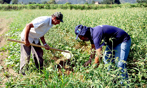
The enumeration surveys carried out by the IBGE involve, from time to time, thousands of enumerators all over the country. The nature of this kind of work requires that all enumeration areas be visited, at least once, during the previously established period for information collection. Therefore, all the paths taking to the places to be registered must be traveled and all the interviews, answered.
The territorial size of Brazil demands a complex logistics to make any survey operation possible, and that obviously includes a great volume of displacements towards the enumeration areas and inside them. To make sure the operations have a good quality, mainly as far as coverage is concerned, the IBGE has been using systems and applications for the management, supervision and support to the census operations which apply to a great extent the data obtained and recorded in the very mobile devices (DMCs) used by enumerators for data collection.
The many advances in mobile equipment and applications developed and used in the 2017 Census of Agriculture opened the way for the use intensification and diversification of the functions offered by the GNSS (Global Navigation Satellite Systems) receivers integrated to the DMCs. The tracking of the geographic coordinates of the agricultural establishments, as well as the positioning of the enumerators, both gave support to field work and provided for a better supervision. This way, faced with the challenge to follow up the operation and assure its quality all over the territory, it was decided, for the first time, to systematically store the coordinates at small time intervals in order to represent cartographically the paths run by the enumerators while doing their work.
The paths recorded during the operation had the pivotal role of serving as a tool for supervisors, in order to contribute to a universal collection coverage in the areas visited by the enumerators. However, as the size and dispersion in the territory were quite big, the paths gained a relevance of their own, becoming a potentially valuable input for new projects of the most different natures, mainly in rural remote areas. In those areas, the paths can be used for new visits of IBGE agents to the field, either in the planning phase or in the collection itself, in the updates of the systematic cartography products, in the works carried out by governmental bodies, companies and civil society entities that need to analyze or manage territorial mobility.
Concepts and methods - Enumerators' Paths
As informações a seguir descrevem os metadados estatísticos, que são o conjunto de conceitos, métodos e aspectos relacionados às estatísticas, e são informações necessárias para compreender as características e a qualidade das estatísticas e interpretá-las corretamente.
Informações Gerais
Objetivo
Obter informações sobre a organização e a estrutura dos setores agropecuário, florestal e aquícola do País. São exemplos de dados estruturais típicos as características do estabelecimento e do produtor, pessoal ocupado, utilização das terras, efetivo da pecuária, produção vegetal e animal, dentre outros.Tipo de operação estatística
Censo agropecuárioTipo de dados
Dados de CensoPeriodicidade de divulgação
QuinquenalPopulação-alvo
Responsáveis pelas atividades desenvolvidas nos estabelecimentos agropecuários existentes no País na data de referência da pesquisa. Esse universo pesquisado é composto pelos estabelecimentos agropecuários envolvidos nos segmentos de agricultura, pecuária, aquicultura, avicultura, ranicultura, apicultura, sericicultura, extração vegetal e silvicultura. Incluem-se os estabelecimentos independentemente do seu tamanho, de sua forma jurídica, ou de sua localização em área urbana ou rural, tendo como objetivo a produção para subsistência e/ou para venda. As produções particulares e os animais pertencentes aos empregados e ao pessoal residente no estabelecimento foram levantados nos questionários do produtor ou em outro questionário, caracterizando um estabelecimento agropecuário sem área. Excluem-se da investigação os quintais de residências e as simples hortas domésticas.Metodologia
A realização das entrevistas e o armazenamento dos dados foi facilitado pelo uso do DMC - Dispositivo Móvel de Coleta, distribuído para os recenseadores, com os questionários e alguns endereços já carregados. As informações obtidas puderam ser encaminhadas com mais agilidade para o SIGC - Sistema Integrado de Gerenciamento e Controle, permitindo mais celeridade na correção de inconsistências.
Técnica de coleta:
CASI - Questionário eletrônico autopreenchido, CAPI - Entrevista pessoal assistida por computadorTemas
Temas e subtemas
Estatísticas econômicas setoriais, Agricultura, pecuária, produção florestal, pesca e aquiculturaPrincipais variáveis
Características do ProdutorIdade
Sexo
Nível de instrução
Naturalidade
Associação a cooperativas e/ou entidades de classe
Local de residência
Tempo de direção do estabelecimento
Condição legal do produtor
Condição legal das terras
Características do estabelecimento
Utilização de energia elétrica
Utilização de força mecânica e/ou animal
Utilização de práticas agrícolas
Utilização de agrotóxicos
Utilização de adubos e/ou corretivos do solo
Utilização de agricultura orgânica
Utilização das terras
Área irrigada por método de irrigação
Silos e depósitos
Máquinas e veículos
Consumo de combustíveis
Pessoal ocupado
Pecuária
Efetivos e produções
Produção vegetal
Silvicultura
Horticultura
Extração vegetal
Lavoura permanente
Lavoura temporária
Agroindústria
Valores monetários
Valor de produção
Receitas
Dívidas
Investimentos
Financiamentos
Valor dos Bens
Unidades de informação
Unidade de investigação
EstabelecimentoUnidade de análise
Pessoa, Família, Estabelecimento, Produto, Município, Unidade da FederaçãoUnidade informante
Pessoa, Estabelecimento.Períodos de referência
Data - 30/09/2017
Data de início da coleta
02/10/2017Data do fim da coleta
01/03/2018Disseminação
Formas de disseminação
Publicação Digital (online), Publicação impressa com CD-ROM, Banco de Dados Agregados - SIDRANível de desagregação geográfica
MunicípioNível de divulgação
Os dados estarão disponíveis em nível Brasil, Grandes Regiões, Unidades da Federação, Mesorregiões, Microrregiões Geográficas e Municípios.Instrumentos de coleta
Histórico
A edição do Censo de 2006 caracterizou-se tanto pela inovação tecnológica introduzida na etapa da operação de campo, com a substituição do questionário em papel pelo questionário eletrônico desenvolvido em computador de mão, o Personal Digital Assistant - PDA, quanto pelo refinamento metodológico, especialmente no que diz respeito à reformulação de seu conteúdo e à incorporação de novos conceitos, visando melhor captar as transformações ocorridas nas atividades agropecuárias e no meio rural desde a realização do Censo Agropecuário 1995-1996.
A data e o período de referência foram peculiares no Censo Agropecuário 2017, visto que, apesar de contemplarem 1 ano completo, o início e o final não coincidiram com o calendário convencional. A data foi 30 de setembro de 2017 e o período de referência de 1 de outubro de 2016 a 30 de setembro de 2017. O equipamento utilizado para a entrevista e coleta dos dados foi o DMC (Dispositivo Móvel de Coleta) que possibilitou, entre outras funções, a transmissão quase imediata dos dados para o SIGC (Sistema Integrado de Gerenciamento e Controle), permitindo agilidade na crítica e correção das informações obtidas.
Description
The Census of Agriculture investigates information on agricultural establishments and agricultural activities developed inside them, including characteristics of the producers and establishments, economy and employment in the rural area, livestock, cropping and agribusiness. Its data collection unit is every production unit dedicated, either entirely or partially, to agricultural, forest or aquaculture activities, subordinated to a single administration – producer or administrator –, regardless of its size, legal nature or location, aiming at producing either for living or sales.
The first Census of Agriculture dates back to 1920, and it was conducted as part of the General Census. It did not take place in the 1930s due to reasons of political and institutional nature. From 1940 onward, the survey was decennial up to 1970 and quinquennial later on, taking place in the beginning of the years ending in 1 and 6 and relating to the years ending in 0 and 5. In the 1995-1996 Census of Agriculture, the information was related to the crop year (August 1995 to July 1996). In the 2006 Census of Agriculture, the reference for the data returned to be the calendar year. The 2006 edition was characterized both by the technological innovation introduced in the field operation, in which the paper questionnaire was replaced by the electronic questionnaire developed in Personal Digital Assistants - PDAs and by the methodological refinement, particularly concerning the redesign of its contents and incorporation of new concepts. That edition also implemented the National Address List for Statistical Purposes - Cnefe, which gathers the detailed description of the addresses of housing units and agricultural establishments, geographic coordinates of every housing unit and establishment (agricultural, religious, education, health and other) in the rural area, bringing subsidies for the planning of future IBGE surveys. The 2017 Census of Agriculture returned to reference the crop year – October 2016 to September 2017 –, though in a different period than that adopted in the 1995-1996 Census of Agriculture. New technologies were introduced in the 2017 survey to control the data collection, like: previous address list, use of satellite images in the PDAs to better locate the enumerator in relation to the terrain, and use of coordinates of the address and location where the questionnaire is open, which allowed a better coverage and assessment of the work.
The survey provides information on the total agricultural establishments; total area of those establishments; characteristics of the producers; characteristics of the establishments (use of electricity, agricultural practices, use of fertilization, use of agrotoxins, use of organic farming, land use, existence of water resources, existence of warehouses and silos, existence of tractors, machinery and agricultural implements, and vehicles, among other aspects); employed personnel; financial transactions; livestock (inventories and animal production); aquaculture and forestry (silviculture, forestry, floriculture, horticulture, permanent crops, temporary crops and rural agribusiness).
The periodicity of the survey is quinquennial, though the surveys in 1990, 1995, 2000 and 2005, 2010 and 2015 were not carried out due to budget restrictions from the government; the 1990 Census of Agriculture did not take place; the 1995 survey was carried out in 1996 together with the Population Counting; the 2000 survey did not take place; that of 2005 was carried out in 2007, together with the Population Counting once again; that of 2010 did not take place and that of 2015 was carried out in 2017. Its geographic coverage is national, with results disclosed for Brazil, Major Regions, Federation Units, Mesoregions, Microregions and Municipalities. The results of the 2006 Census of Agriculture, which has the calendar year as the reference period, are not strictly comparable with those from the 1995-1996 Census of Agriculture and 2017 Census of Agriculture, whose reference period is the crop year in both cases.
Time series
#seriehistorica20176584956305
#tabelasidra20176585414459
#seriehistorica2017659333529
Downloads
Technical Information
Methodological considerations on the Census of Agriculture can be obtained in the Technical notes chapter of its results publication.
Technical notes
- Tecnical note 01/2018 - Release of the List of Agricultural Establishments of the 2017 Census of Agriculture
News and Releases
2017
Atlas of Rural Area depicts diversity and inequalities in the Brazilian field
As part of the events to celebrate the 100th Anniversary of the Census of Agriculture, the IBGE releases...
15/12/2020
2017
IBGE wins award for agricultural survey and studies
The IBGE and the former technical coordinator of the Census of Agriculture, agronomist Antonio Carlos...
16/10/2020
2017
Census of Agriculture celebrates its 100th anniversary portraying the history of the sector in the country
From a family establishment of tomato farming in a rural area of a small town to a big cattle raising...
01/09/2020
2017
IBGE includes meso-region and micro-region territorial divisions in 2017 Census of Agriculture data
Data from the 2017 Census of Agriculture with territorial divisions of meso-regions and micro-regions...
18/08/2020
2017
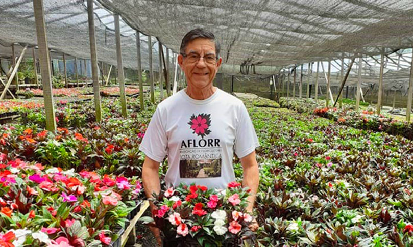
Know stories and motivations behind the work of flower growers
Agronomist Laerte Correia began to produce flowers when he was 56 years old in 2007, after years providing...
24/01/2020
2017
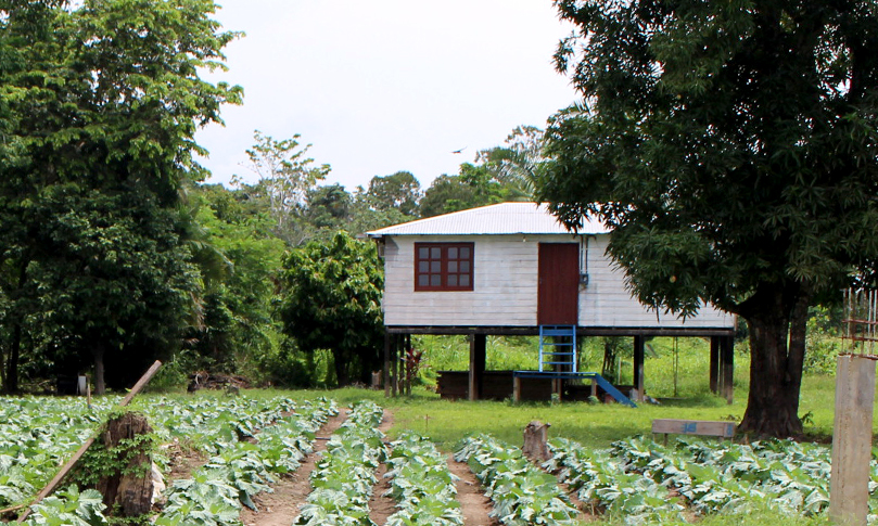
Water sets the pace of agriculture in Amazonas
In a village full of farmers located in the Terra Nova district, municipality of Careiro da Várzea (AM),...
10/01/2020
2017
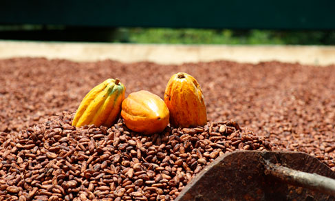
In Bahia, descendants of Japanese invest in cocoa
Last December 18 was the International Migrants Day. In Brazil, the presence of migrants from several...
27/12/2019
2017
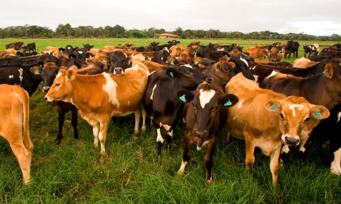
Milk productivity increases 62% in 11 years, reaches 30 billion liters
The production of cow milk surpassed the milestone of 30 billion liters for the first time ever in the...
20/12/2019
2017
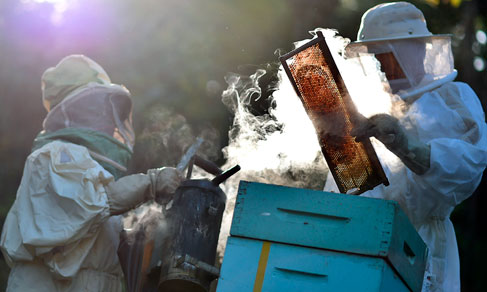
Beekeepers are nearly one-fourth of landless producers in Minas Gerais
Of the more than 5 million agricultural establishments surveyed in the 2017 Census of Agriculture, nearly 1.5% had...
13/12/2019
2017
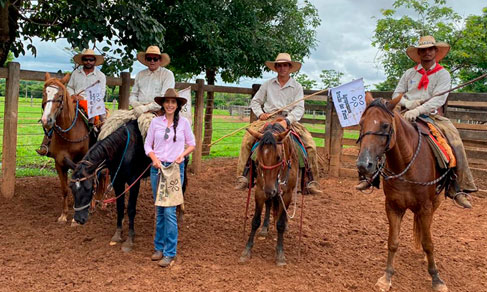
Women gain space in agriculture, yet they are only 19% of producers
Twenty-year old Carmen Perez became the head of a farm in Barra do Garças, a municipality in the interior...
06/12/2019
Errata
Calendar error in the release of 2017 Census of Agriculture - General characteristics of agricultural and mining productions, according to color or race of producer and specific territory divisions
Published date: 22/11/2022
Description:
Error, pinpointed by the IBGE, for not meeting the release date of the survey, according to a Notice published on the IBGE Portal on October 24, 2022, which would be November 24, 2022. The new release date will be December 14, 2022.
The product was postponed as its technical team was temporarily relocated to the demands of the 2022 Population Census, which led to new deadlines.
Actions: The release calendar was changed.Correction of data on the output of orange in the 2017 Census of Agriculture
Published date: 06/08/2020
Description:
An error regarding the output of orange in São Paulo was identified in one of the 2017 Census of Agriculture questionnaires.Actions: The questionnaire was corrected with the right figures. The corrected data and the derived variables were uploaded to the database.
Correction of data on silviculture in the 2017 Census of Agriculture
Published date: 06/08/2020
Description:
Questionnaires with the indication "Other silviculture products" instead of “Logwood" (for Other Purposes) - M³” were identified.Actions: The questionnaire was corrected with the right figures. The corrected data and the derived variables were uploaded to the database.
Correction of data on wildcrop harvesting products in the 2017 Census of Agriculture
Published date: 06/08/2020
Description:
Questionaires with "Other wildcrop harvesting products" instead of the specified products were identified.Actions: The questionnaires were corrected with the right products. The corrected data and the derived variables were uploaded to the database.
Correction of data on categories of affiliation to cooperatives in the 2017 Census of Agriculture
Published date: 06/08/2020
Description:
A modeling error was identified in the table of categories of association to categories and professional entities, resulting in incorrect data on affiliation of agricultural establishments.Actions: Modeling data were corrected.
Modeling of tables by decimal place in the 2017 Census of Agriculture
Published date: 06/08/2020
Description:
Differences in rounded figures were identified at more aggregated levels.Actions: The data were reaggregated with corrected figures, considering rounding rules.
Modeling of tables for total frequency of establishments in the 2017 Census of Agriculture
Published date: 06/08/2020
Description:
Total establishment figures by survey section were above the real ones. The reason for the error was that, in cases where the establishment had more than one product (products from permanent crops, for instance), it was counted as “Total”, as many times as the number of products included, when it should appear only once in the “Total” category.Actions: The data were aggregated with the frequency of establishments for the “Total” category with a single count of the establishment in case it presented more than one product per section.
Calendar error in the release of the Census of Agriculture 2017
Published date: 30/05/2019
Description:
An error, detected by the IBGE, relative to the non-compliance to the Census of Agriculture 2017 release date, as informed in the calendar made available in December 2018. Due to the need of rescheduling, the new release date of results of the Census of Agriculture 2017 is October 25, 2019.Actions: The release calendar was changed.
Ratification of values on the map "Number of agricultural establishments, by municipalities" in the PDF files of the Preliminary Results of the 2017 Census of Agriculture
Published date: 13/12/2018
Description:
Value inconsistencies were detected on the map "Number of agricultural establishments, by municipalities" in the PDF files of the "Preliminary Results of the 2017 Census of Agriculture" of Mato Grosso, Goiás and Mato Grosso do Sul.
Actions: Values were amended and PDF files generated again replacing the previous ones.Correction of the unit of measurement of the herd of poultry in the 2017 Census of Agriculture Preliminary Results
Published date: 12/11/2018
Description:
An error was detected in the unit of measurement for "head" in the release of the 2017 Census of Agriculture Preliminary Results for the herd of chicken. The value presented refers to the total herd, and it is not necessary to multiply it by 1,000 (x 1,000) as before.
Actions: Change of the unit of measurement "x 1.000 head" into "head"in the release of the 2017 Census of Agriculture Preliminary Results for the herd of chicken. Correction was necessary on the 2017 Census of Agriculture Census page (https://censoagro2017.ibge.gov.br) and in the channel Cities@ (https://cidades.ibge.gov.br). On the IBGE website, the unit of measurement had been properly displayed.Replacement of color-and-contrast-adjusted photos for original images
Published date: 06/09/2018
Description:
It was observed that some photographs nominated for the Census of Agricultur Photo Award, made available on the voting platform, had undergone olor and contrast adjustments not allowed by the rules.
Actions: The adjusted photographs were removed from the website and their original versions were uploaded in place. All those who had already voted in this phase of the contest were informed of the error, so that they can vote again if desired.